 |
|

1 Feb 2011
|
|
Registered Users
HUBB regular
|
|
Join Date: Aug 2009
Posts: 94
|
|
And on we go.

These are the one's that make you nervous. Weeds on the side, trail going off into the bush and turning a corner so you can't see how far the water keeps going.

At this point I starting to think that this is working out pretty damn well. Lot's of water, but this should be close to high water level's and we haven't come across anything that doesn't have a gravel bottom or is too deep.

The water crossing with the large rocks in them require a slow and steady speed. Just enough so you bounce up over the rocks but not soo much that you'll endo. Going to slow will lead to a tip over and you come to a stop and loose momentum. But there are so many of them that we are all in a groove and doing fine.


My turn to walk one You just have to know that at some point your luck will run out. Better safe than sorry.


I don't have a pic but I think this is the one Dan decided to cool off in after a tip over ? Never a camera around when you need one eh Dan
Now don't get me wrong, this trail wasn't just water crossings. There were also some very fun dry sections.


Just as things were going well, we check the gps and maps. Looks like another 6 km's until we pop out onto a road again. yehaa almost there ! Minutes later we come over a rise and are greeted by this view.

A quick conversation is had..... where is the trail? That can't be it ...that long dark watet section....it's got to go out and around in the bush and we just can't see it..... well let's head down and find out ....
If it wasn't for the unknown "where does the trail go now feeling" this would have been a nice vista. I love when the trail your riding dissappears from your line of sight in the horizon.

Well down we go. Loose rocks, steep and I can't help but notice that it doesn't seem like many vechicles came down here. Grass growing out of the middle of the track .... hmmm .......
Get to the bottom and are greeted by this view

A quick look around and I can see a fire pit, old spark plugs, old rubber belts from a truck and other signs that some one spent the night here working on a vechicle. Sh1t, damn, arg. Juames goes and checks the inevitable, slick mud bottom and about 20 feet in he sinks to past his knee's
Damn we were so close to the end of this trail. Did we go the wrong way somewhere ? A quick check of the map shows that we are on the right track.

Why is that everytime I get stuck it's at the hottest point in the day, humidity jumps, and the bugs come out for a feeding frenzy. I guess being down low here out of the wind and right besdie a swamp explains it, but still ..........
Ah crap we're going to have to ride back up that steep hill covered in loose rocks I don't see this working out too well for us.
|

1 Feb 2011
|
|
Registered Users
HUBB regular
|
|
Join Date: Aug 2009
Posts: 94
|
|
Got to the top of the hill looked back and saw this

What you can't see is Dan in almost the same position further down the hill. Why pictures make hills look lame is beyond me but this one was fairly steep and the rocks were very loose. A bit of pushing and grunting and we all got back under way to retrace our path.

And yes I put the camera down and helped out
Riding through all the water was much easier when you have confidence of what's under it.
After some debating over the maps we found another trail that lead off the hydro line. This enabled us to keep apart of the hydro line in the route

Check out the BIG bug in the above photo :ylsmoke:

Part way along the side trail (which turned out to be fun and fast) I had a quick chat with a local guy who has a hunt cabin in the area and know's the lay of land fairly well. I mentioned we had come from the hydro line and he laughed and said "you didn't make it did you, that swamp gets deep". Looks like we made a good call on turning around. he did however mention that there is a go around but it involves riding up and over and through a large boulder garden. He laughed when I asked if it was doable on our bikes. "I did see someone do it on a bike but it was a small little dirt bike". Enough said for us, we're here to make a route for bikes packed with gear, not to create the world's hardest enduro course.

After a few miles of the new trail we came across this and I thought ah come on

It appears as if the bridge is just getting some work done to it, yehaa...finally the route is progressing

Came across this little stream which was great to cool off in.


Rolled into the small town of Flinton Ontario. Not much here but a small general type store with a sweet lady who makes soup and sandwichs. Great food, I'd highly recommend stopping in when you come through here. real salt of the earth type of folks. Heck she even felt bad about overcooking my grilled cheese and apologized and offered to make me a another one at no charge. This is why I enjoy travelling through these out of the way places, the people are golden.

After lunch we broke out the maps and figured out how to get back on track. It looked like there were some gravel roads heading back to where we wanted to be. Sadly it'll involve a few short paved sections but it's the best we could come up with. Sometimes a bit of slab just to get the wind running through your jacket can be a good thing
Off we go....we make it about another 30 km's down a gravel road and stop at a stop sign. I take off and ride another 20 km's and wait at the next intersection...where is everyone? Wait an appropriate amount of time then start retracing back to where I last saw them. You can't help but think one of three things has happened.
One: Someone had an accident
Two: Someone had a mechanical
Three: I went the wrong way and now the epic how do we find each other again begins
Well turns out it was option two. Juames bike has had an electrical glitch of some sort and has no power. When I get back to them his bike is stripped of gear, seat, fairing, etc Much poking and prodding and trying this and trying that and we came up with either the battery is toast (he just put a new one in a month or so earlier or he has a short that draining the electrical system). Lucky for us it was the KLR and not one of the KTM's. A KLR doesnt require a battery to run. The ignition runs off the stator A few attempts to get it bump started and away we go...only to see it die again another 100 metres down the road. The petcock had been turned off when we were about to remove the tank
A group decision was made, do we camp for the night then find someone with an voltage reader in the morning or do we call it quits and head home. Well we decided to head home. Hard call indeed. The tipping of the scales was that two of us are married and getting a weekend off to go biking isn't something we get to do every week, so it was decided that it would be better to limp home, get the problem sorted out and return in two weeks to finish making this section of the route. (I know your thinking your married and you get to do this much biking? Well Mrs. Deadly either doesn't like me or she understands me and puts up with me taking off many times a year for bike trips....... I think....I hope...it the latter )
A stop for dinner on the way home and a few coldies to drown our sorrows in.

There's something about having a cold one after riding with your buddies and recalling the moments of the day that simply puts a smile on your face.


After a retarded session of trying to bump Juames bike and subsequently sweating out the bevies we headed home. Juames must have been cutting it close with his little to no headlight due to no battery before it got dark.

Well another chunk of the route got completed, we had a good time and rode some fun terrain :sombrero:
|

1 Feb 2011
|
|
Registered Users
HUBB regular
|
|
Join Date: Aug 2009
Posts: 94
|
|
And here comes the next attempt at pushes the route west across the province of Onatrio 
Packed up the bike and headed out, sky was sunny and the forecast was looking good


Met Chris and Jimmy at Timmies in Perth, Ontario. Caught up and went over the day's plan. Everybody seemed in good spirits. I hadn't seen Chris since we parted ways in Newfoundland a month ago. His GS was showing some impressive battle wounds from his high speed endo on the Trans Lab. Jimmy as usual had the maps out and the route highlighted and his gps loaded up with the intended route

Hit the road to catch up to where we last left the route. This was also the spot where Frank would be meeting us. I hadn't met Frank before, I believe he read this thread, got in touch with me and voila...he's coming along. He self admitted his skills may not be what some others are. He rides a Harley ultra glide and just recently picked up a 990 adv and took a 2 day off road course, went and rode the Trans Lab this summer and then came and joined us for a few days of the TCAT ......


After meeting Frank we hit the road. The route begins with some asphalt twisties and some gravel roads.

The route then gets on an old rail line and heads north to the town of Bancroft. For the most part the rail trail is fast and smooth, a few sandy sections but nothing to really be concerned about. 80- 100 km's in ;length if memory serves, so a couple of hours depending on your speed. Some nice scenery, blah blah blah I really enjoyed this trail, nothing demanding just a stand on the pegs and enjoy the ride.
NOTE: The main route will take a gravel road (it's a good one) that paralell's this trail. Due to legality reasons I don't believe trucks are allowed (still looking into this, some swear it is, some say it isn't.


Entering the town of Bancroft. I really like the fact that some towns around this area really embrace bikes/quads/sleds as a form of tourism. This particular trail goes right into the middle of town. You can see the trail on the right side of the road, I wish every place on earth had trails like these


A quick scoot down mainstreet for some gas and  . Yes in this area of Canada you can only buy  in one place, The Beer Store. It's government controlled and more times than not it's not open on Sundays and closes at 6 pm on Saturday nights, plan accordingly


We slabbed for a dozen miles down to a provincial campground called Silent Lake Campground. Like all government run campgrounds, it's clean and whatnot. During peak season the gal at the front informs me a reservation is a must do.

Yep, they also rent yurts by the night. 90 bucks, sleep six. Not bad if it's raining and you don't feel like setting up the tent. Don't quote me on this but I think the gal said they have about 70 of them and plan to build more.


Setup camp for the night, got a fire going. Drank way too much cheap Inidan whiskey, just kind of happened, all of a sudden I realized I was slurring, ah well, it was a fun night shooting the ****, bench racing and whatnot.
The check in office


Ate a god aweful dinner. Never again do I eat boil in the bag freeze dried crap. I had a few bags left over from previous trips and as I was on a budget I decided to bring it along. To those who actually enjoy this crap..... 
|

1 Feb 2011
|
|
Registered Users
HUBB regular
|
|
Join Date: Aug 2009
Posts: 94
|
|
|
|

1 Feb 2011
|
|
Registered Users
HUBB regular
|
|
Join Date: Aug 2009
Posts: 94
|
|
NOTE: This next post is written by Stephen and reflects his take on the day
Well, Friday and me being the only person who couldn’t get the day off work I ended up getting a late start to things. I work in Arnprior so I rode my bike so I could leave right away and make my way to Bancroft.
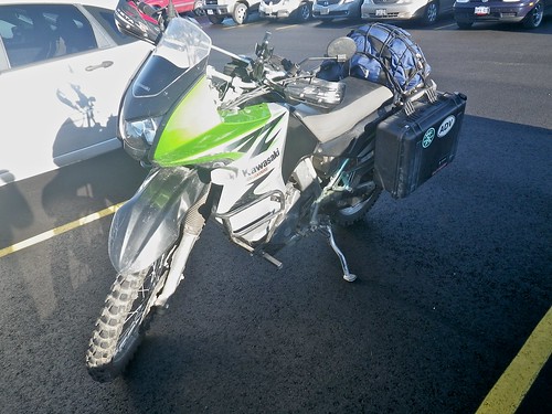
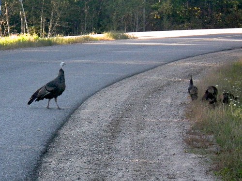
Taking the nice scenic back roads through Calabogie I came across some wild dinners.. err. I mean wild Turkeys and some beautiful lakes where I just HAD to stop and take some ‘glam’ shots of my bike...
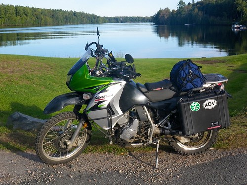
Later I rolled through the beautiful town of Bancroft and topped up my fuel for the next day’s ride. After that I thought I’d take some “back trails” to the campground. Well that was a mistake! I got about 2km down the trail and came to a short little water crossing with a culvert near the far end. Little did I know that it got super deep just as you got to the culvert. The next thing I know my front wheel is 3 feet in the air then my back tire hits the culvert and I slam down on my skid plate. I start to tip over but I save it before all my gear gets dunked in the water breaking off my right side mirror in the process. Now my bike is beached on the skid plate with the back tire floating in 2 feet of water. I'm alone, fully loaded, no one knows where I am and I'm about 3Km down this trail. Not good.
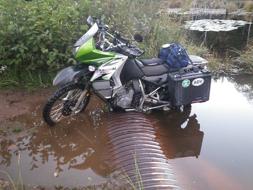
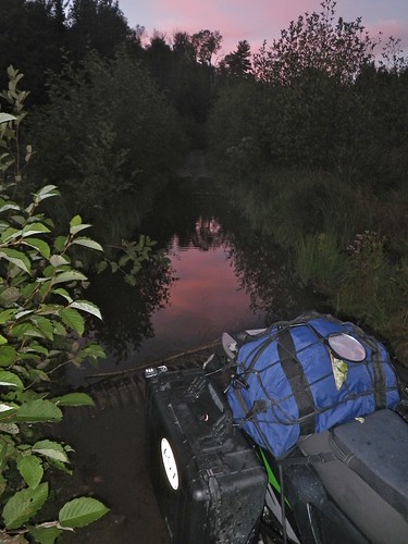
After much rocking and huge roost of water I finally get enough traction to get up the other side. At this point it’s getting late and my GPS says I’m less than 500 meters from the campground. Only a few more hills and I’m there! I hop back on and come to a gnarly steep climb. I gear down and gun it, dodging rock and sliding in the mud with nary a foot dab to get me to the top and that’s when I see the mud hole. ARG!!!! This thing was big, deep, and cris-crossed with 4-wheeler tracks. It was that thick mud that sticks to everything. The sun was almost down and I was tired so I said “Screw this” and turned around.
The culvert water crossing was easier in reverse and I made my way back out to the main road where I eventually found the proper entrance for the campground and met up with the rest of the guys who were enjoying  s around the campfire.
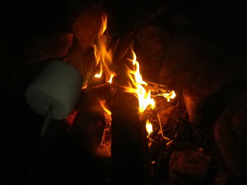
Yes, that's a marsh-mellow.
I busted out my brand new Henessy Hammock and set it up for the first time (I did do a test setup at home but I’ve never slept over night in it). Everything went up well in the dark and joined the team for  s around the fire.
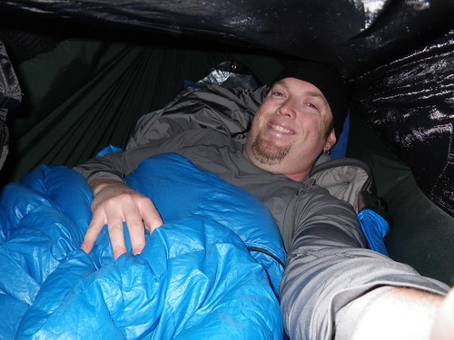
I had a little more adventure than I had hoped for on the way in but I had survived. Later on I heard that the other guys were planning on taking that route but they were too tired from the earlier riding and were glad that I “took one for the team” and scouted it out for them. Little did I know that this wasn’t the last one I would “take for the team” before the weekend was out…
|

1 Feb 2011
|
|
Registered Users
HUBB regular
|
|
Join Date: Aug 2009
Posts: 94
|
|
NOTE : Franks take on the day
I got back from the TLH at the end of August so when I heard about this ride, I signed up thinking it would be a nice follow up to the TLH. Just a small ride - 3 days, no big deal. So I headed out from Kitchener at 9:30 intending to make it to Tweed, about 10km south of the meeting point by 1:00. The RDV was at 2:30 but I had to cross Toronto on a Friday so a contingency was in order.
Toronto traffic was flowing so I got to Tweed by 1:00, filled up, bought a lighter - didn't think showing at a campground without a lighter would impress my travel mates. That would be almost as bad a planning to eat camp food all weekend and not bring any utensils.
I met up with the guys and we left at 2:30 sharp. I was a little apprehensive because these guys were on a mission and I didn't want to slow them down too much. They assured me they were not on a clock. We drove to the Hasting Heritage Trail and I was starting to feel pretty good. The 990 just loved that kind of riding. The ride to Bancroft was only about 75km but it gave me the opportunity to get my sea legs - or so I thought.
It was a beautiful day and setting up camp by 5:30 was really nice. A few  s, tales of adventures past and future, and everyone turned in. I was feeling pretty good about my decision to tag along. I didn't take any pics on this ride so I'll be relying on the other mates to provide the colour of the ride.
NOTE: Chirs's take on the day
Ted's covered most of the first day but I thought I'd throw in a couple of pix-
Typical section of the old rail bed.. firm gravel, gentle curves and hills, excellent scenery, a real pleasure to ride! Hardly any soft sand or endless sandy whoops, barely any water splashes, and no loose boulder strewn climbs. A nice way to ease into the weekend.
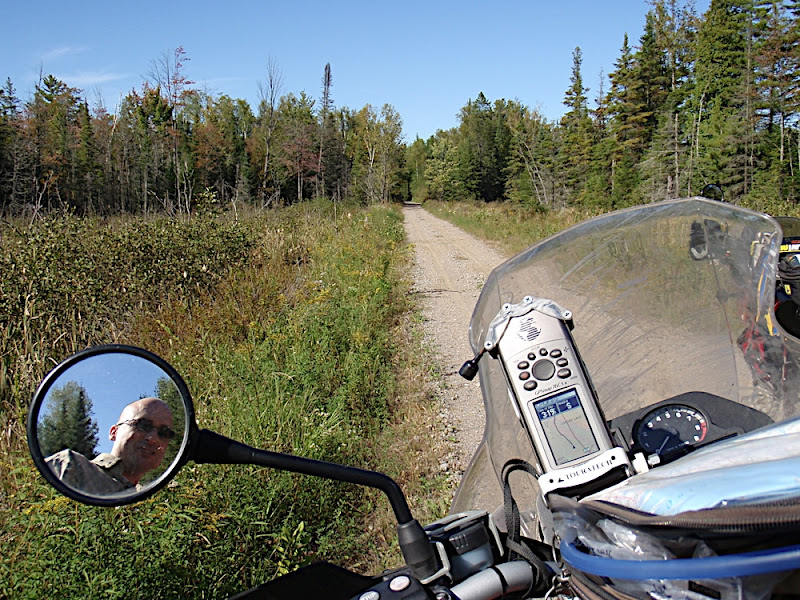
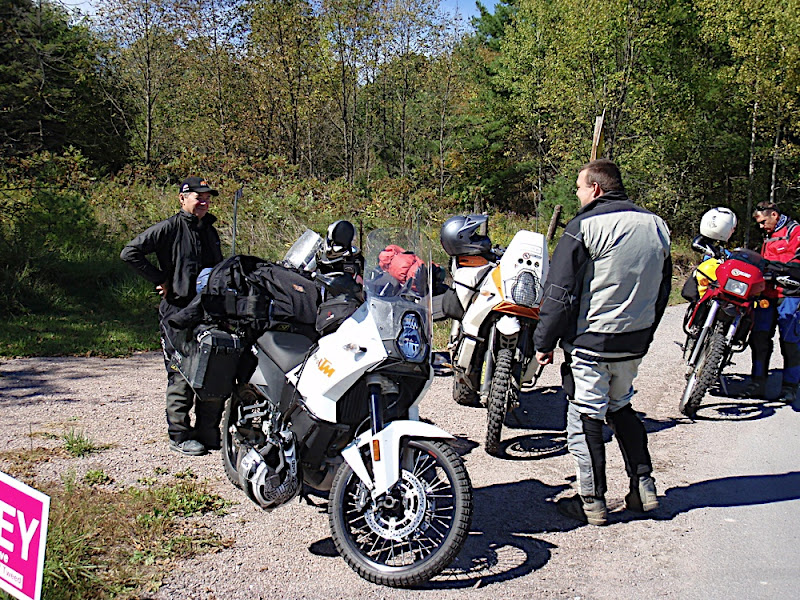
Frank and Ted talking KTM stuff. Jimmy the Map Man figuring out the next section.
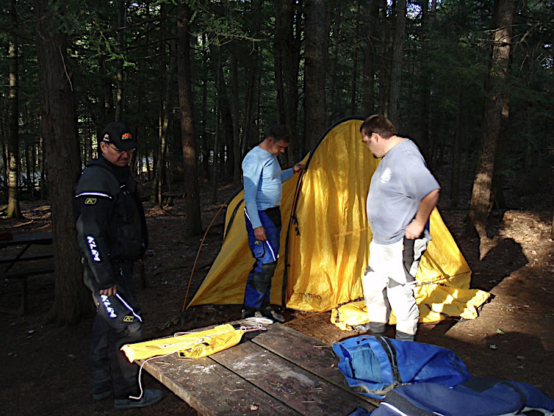
Ted has not used the tent since the Trans-Lab trip and completely forgets how to assemble it. Not to mention that the elastic cord inside the poles is broken so he has to put together a dozen small sections, carefully thread it through the sleeve just right otherwise it all falls apart. Plus some parts are missing. Or broken. Something about gear falling off his KTM at high speed in the middle of Labrador.
Happily we stopped to camp at around 5pm and had a few hours of daylight to get set up, drink some  s, swap stories and get the tent up. Jimmy kept managing to walk into the guy wires. Bets were placed on whether Ted's tent would still be up in the morning
Frank, Jimmy and Ted discuss strategies for tent assembly..
|

1 Feb 2011
|
|
Registered Users
HUBB regular
|
|
Join Date: Aug 2009
Posts: 94
|
|
The plan for today was to ride from Bancroft to Kinmount for lunch then continure on heading north through Haliburton and end of in Hunstville for the night.
The morning's agenda had some gravel roads and one double track road called North pencil Lake Road. I'd ridden this "road" early in the year and remember thinking that it would be great to include on the route. At the time I was chasing a group of primarily smaller bikes and we were travelling with no gear. I recall thinking it would be "doable" albeit a bit of a challenge with loaded bikes
The night before I let the guys know about the terrain. I didn't recall any one feature that stood out as being terribly challenging, but rather alot of small features (rocks, water crossing, etc). There was one water crossing that was more than likely going to have to be skipped but there is a bypass atv track up and around it. I was hoping I had over talked it and it would end up being much easier than I had warned them about, usually riding a bike over tough terrain is easier if you havent psyched yourself out, but I didn't want to end up in a situation where everyone looks at you with hatred in their eyes thinking "what an asshat for bringing us here". Better that everyone knew what they would be up against.
So we packed up early in the morning after brewing some beans and having a bite to eat. Seriously, people eat that freeze dried crap and enjoy it? I had an egg/ham and other unidentifiable ingredients. omlet. The eggs were brutal but doable, the ham on the other hand just freaked me out. I forced down about a third of it just to get something into the belly as I had a feeling the day would present a few challenges.


The pace was slow as I had to stop at every intersection to write down info for the roadbook. About 20 kilometers of pavement before we got on a fun twisty gravel road. The roads were wet with puddles....hmmm....last time I road this road it was very dry...a sense of things to come was creeping into my mind.
Turning off the gravel road onto Pencil Lake Rd

Looking up the where we were headed. Wet sand and puddle's......they must have recieved some rain lately .......

Like I was saying, most of the road looks like this, or at least some of it does Nothing crazy but enough washouts, rocks and whatnot to keep you on your toes.

Then the "puddle's" got a bit bigger

Hmmm....I don't recall this many water crossings. The water had a weird algae on it that prevents you from seeing the bottom. Given the nature of the terrain I knew that there were some big rocks in some of them, couldn't help getting that feeling that " it's just a matter of time before I hit one and take a swim". How many of these were in a row? A dozen or so maybe.
Chris becomes the first to get wet


Not long after we got to the "big one". I was kind of hoping we could just ride threw it and not have to mess around with the bypass. Pulled up and we were greeted with this

|

1 Feb 2011
|
|
Registered Users
HUBB regular
|
|
Join Date: Aug 2009
Posts: 94
|
|
|
|

1 Feb 2011
|
|
Registered Users
HUBB regular
|
|
Join Date: Aug 2009
Posts: 94
|
|
|
|

1 Feb 2011
|
|
Registered Users
HUBB regular
|
|
Join Date: Aug 2009
Posts: 94
|
|
More water, more rocks, more fun

Finding the shallow line


Eventually things dried up and the track became fun and fast again. At one point we came a cross a bridge out and a small water crossing to the side of it. A couple of lads on vstroms were there having a look. They had a video camera going as we rode by. One of the lads said they stopped and chatted with them and they said they were inmates at the asylum (advrider.com).....?


After finishing this "road", going from memory here but it's about 25 kilometres long and took us about 2 hours I think, we rode some very fun gravel twisties to the town of Kinmount for lunch. Real rollercoaster roads. A few hills with steep drop off's guarantee you will get some airtime Even the big GS left the ground. Have fun (Salmon Lake Road ), if I had my way we would have spent hours riding back and forth on that one road, but we had other promising roads/trails to get to. I'm not a wheelie guy but my front tire certainly didn't get the same mileage as my rear
|

1 Feb 2011
|
|
Registered Users
HUBB regular
|
|
Join Date: Aug 2009
Posts: 94
|
|
NOTE: Franks view on the morning
Let the noob chime in here... Ted did sow the seed of awareness the night before. But as he described each challenge of Pencil Lake Road he always ended with "...but it's doable". I came to understand that to this crowd all trails fell in the binary classification of being either "doable" or "not doable". The obvious qualifier "by whom" was always conveniently omitted. So when we got to this crossing, and it was deemed "not doable" I had to see for myself as I had already seen the bypass. I had heard the "doable" pronouncement on the bypass and was desperately trying to determine that they had jumped the gun on the "not doable" verdict of the crossing. While I was still hoping against hope I heard the sound of Ted's 950 eating up the trail.
"I guess we're going around".
What was "couple of switchbacks on the other side before regaining the trail" for Ted, Chris, Steve, and Jim was some of the trickiest riding I'd done on the 990 to that point and I kept thinking, "holy **** I can't believe I'm doing that, holy **** I can't believe I'm doing that, holy **** I can't believe I'm doing that." Then as I came to the last 5 feet of the trail, nothing too different from what I'd just done, a sharp turn to the right I looked ahead and thought, "Holy **** I can't believe I just did that", looked up, hit a rock, and went over. So "loss of focus" caused that particular one.
Fortunately Jim was there to help pick up the bike...again.
NOTE: Jimmies take on the morning
I'm pretty much a noob rider myself. Had never ride dirt before last year, and very little at all before that...so I found myself echoing Franks words a few times as I was riding up the 'go around.'
I think Frank was seriously contemplating riding the water crossing... after closer inspection it was deemed 'not doable' to cross without a boat. The water was above knee deep in some spots...with a very sketchy bottom of brown goo that was most likely just as deep...

After all was said and done...we all made it up and around. And I must say the Pencil Lake road is a MUST ride! If you haven't ridden it...do it!!!
|

1 Feb 2011
|
|
Registered Users
HUBB regular
|
|
Join Date: Aug 2009
Posts: 94
|
|
Note: Stephens view of the morning
I woke up after my first night in my hammock rested and ready to hit the trails. I had packed a nice IMP (Individual Meal Packet) of breakfast sausages for myself to enjoy. This isn’t your usual boil in bag. This is genuine Canadian military gourmet cooking. I had sausages, apple sauce, oatmeal, hot chocolate, juice mix, coffee, and a bun with jam all in a neat little package. I did have to warm some of it up but in the end it was a tasty way to start the day and get something warm in my belly.
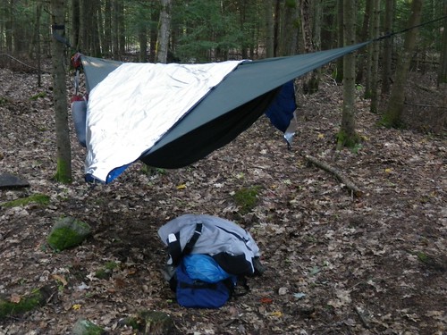
For those who are interested, the hammock worked out great. I had to get up and fiddle with the height of the foot end to make it a bit lower. I also was a bit concerned about my stuff. The only place to keep any of it was on the ground under the hammock. If there was a driving rain it might have gotten wet so I might pack a giant garbage bag for next time and just shove everything in that, then put it under the hammock.
Not 5 minutes down the highway from the campground we were on the trail, and what a trail it was! All snowmobile trails in the winter they were a good run of hilly twisty double track. Nothing too difficult but just enough puddles and interesting terrain features to not get bored.
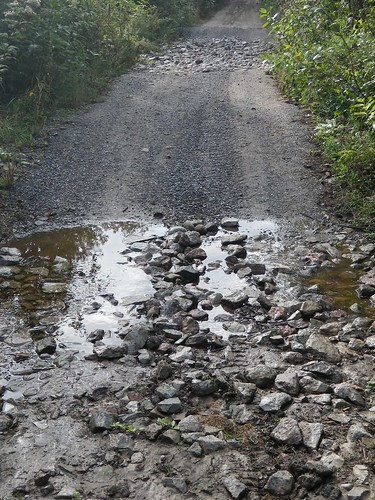
The trail.
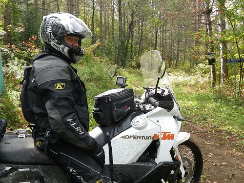
Frank stopped at an intersection.
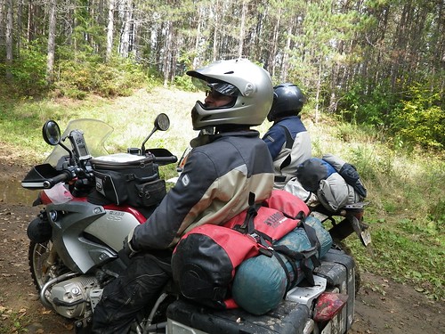
Chris waiting to find out which direction to go next.
Some of the puddles were bigger than others and needed a certain amount of caution when going through. So far nothing was too difficult and we made decent time on our fully loaded bikes.
That’s when we came to the big one. WOW. Ted had warned us about the big puddle we were going to have to face but I was confident that it would be no problem because of the “bypass”. Well that bypass is not the easiest option either. A decently steep uphill through the woods to get to a open section of lumpy rocks followed by a steep and twisty downhill back through the woods.
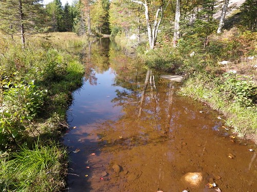
The big water hole
We checked it out thoroughly and concluded that it might be possible to do we all decided that pushing bikes across the bypass would be easier and quicker than striping a bike and trying to drain it of water.
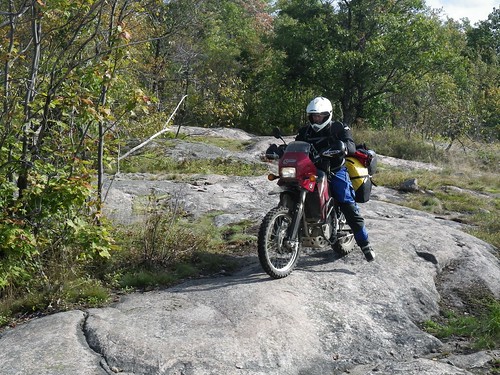
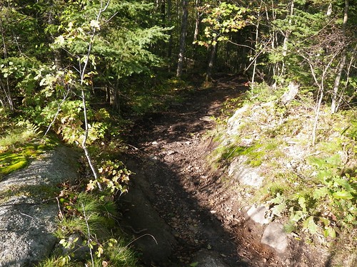
The decent. It’s hard to see but easy enough if you take it slow.
The bigger bikes walked their luggage across and the smaller bikes rode the bypass with no problems. Eventually we were all on the other side, safe and most importantly DRY!
Not for long…
As I was near the back of the pack we came upon the glorious sight of Ted up to his knees in water standing on his bike.
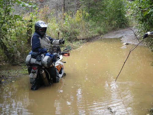
We all parked and proceeded to test the water with sticks to map out what the bottom was like. As it turns out there is a pair of ruts near the left side but the right side is only a foot deep. We would all have no problem getting across but there was still the matter of getting Ted unstuck.
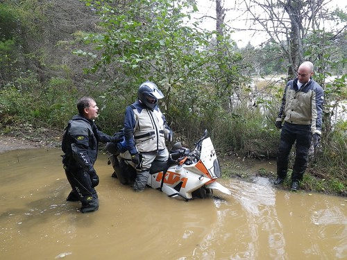
In the end, and with soggy feet, Ted was freed and we all crossed the puddle without any more issues.
|

1 Feb 2011
|
|
Registered Users
HUBB regular
|
|
Join Date: Aug 2009
Posts: 94
|
|
After finishing this "road", going from memory here but it's about 25 kilometres long and took us about 2 hours I think, we rode some very fun gravel twisties to the town of Kinmount for lunch. Real rollercoaster roads. A few hills with steep drop off's guarantee you will get some airtime Even the big GS left the ground. Have fun (Salmon Lake Road ), if I had my way we would have spent hours riding back and forth on that one road, but we had other promising roads/trails to get to. I'm not a wheelie guy but my front tire certainly didn't get the same mileage as my rear
Kinmount for lunch


After lunch I think we all felt a bit tired. The late night before, the mornings trail and a hot meal certainly gave me the yawns. Just outside of town we jumped on the next trail. Another rail trail, fast and smooth. I really enjoy the just stand on the pegs, twist the throttle, get into a rythm type of riding.


About half way down this trail I stopped to look at the signs. WTF atv's allowed but motorcycles are not. Who the feck made that dumbass rule? They must have had an issue with 2 strokes at some point in time. ****ty deal for us as this trail connected two spots on the route. We got the maps out and plotted a new route up to the next destination. It looked promising. As it would turn out the roads we assumed were gravel were paved, the gravel ones dissappeared into nothing. Well this wasnt the way this section is supposed to be. There must be other fun trails or old gravel backroads we could be taking. The decision was made to just hit the highway and bomb up to Huntsville before the rain came. I'll have to spend some time with the maps next week and find an alternate method to connect the towns of Kinmount and Huntsville....maybe one of you out there has a suggestion Shoot me an email if you do, thanks.


Slabbing

It started raining just as we were pulling into Hunstville around 5 o'clock. Everyone hit the liquor store to get out of the rain and pick up some supplies. After 5 minutes of everyone playing with their iphones and blackberries, it looked like the weather would clear up in a couple of hours. Frank opted to grab a motel while the rest of us heading to a campground just outside of town.
Setup camp, ate some dinner, had a bevy or two, dried our gear over the fire and put heads to pillows.

The Nomad Tent's vestibule payed off again. Room inside to standup and change out of my wet gear, hang my gear up to dry, sort stuff out and whatnot. The extra few pounds are well worth it. This isnt the first time this tent has "saved" me from bolting to a motel in inclement weather.


Another fun day indeed Sleep came easy that night.
|

1 Feb 2011
|
|
Registered Users
HUBB regular
|
|
Join Date: Aug 2009
Posts: 94
|
|
http://vimeo.com/15199945
A short vid of a few of the backroads.
NOTE: Pencil Lake Road will be one of the optional technical sections. The main route will travel gravel roads north around this section and offer there own excitement. Some great hills and twists for fun along with some great scenery.
A short video Stephen threw together of some of the terrain that can be expected for the optional technical sections in Ontario
YouTube - Ompah Dirt
|

1 Feb 2011
|
|
Registered Users
HUBB regular
|
|
Join Date: Aug 2009
Posts: 94
|
|
Day three of this ride had us up and at it early in the morning. Frank showed up looking well rested and ready to go. A quick pack up and we were off to the Timmies down the road for a warm cup of coffee....and a plumbed bathroom
The cool night had created a bit of fog for the morning but the sun was doing it's job of burning it off.


The view from the Tim's. Huntsville is a nice town. If I were to take a break for a day or two while doing this route, I think this town would be a good spot for it. Laundrymat, motels, campgrounds, fast food, grocery stores and whatnot are all available. The town itself is a bit touristy, but hey...we're tourists aren't we ?

The agenda for the day was to get on the Seguin Trail LINK
Ride this trail to where it meets the Nippissing Trail LINK
A side diversion to see the "Field of Screams" and finish this section of the route of in a small city called North Bay. Then slab back to Ottawa. A long day indeed.
We hit the road and got on what we thought was the Seguin Trail


This trail ended all of a sudden....hmmm...this can't be right. Maps out, gps hard at work.....ahh...it starts over there....off we go to find "the real trail"
Well the trail was certainly more of an atv trail than an old rail line (too many twists and hills to be a rail line) but it was fin and went for about a half hour, and it was heading in the right general direction.

The trail ended at a hudro line with no visible exit going forward. We tried heading left on the hydro line, a couple of water crossing later and we ran into a private land sign. We turned around and tried the other direction. What we didn't know.....was that Juames and Frank didnt see us go the other direction down the hydro line, they assumed we had gone back up the atv trail Well the way we went soon ended at another private land sign so we turned around. Where the heck did the rest of the group go? Stuck in the water crossing? nope...hmmm..is there another way out of here, looked around, nope. **** they must be headed back up the atv trail, and probably giving it throttle thinking they are trying to catch up to us.
So we were now two groups instead of one. We tried following tracks down the gravel roads, after a few T intersections we stopped, back tracked, left one of us at each intersection...you know all the tricks. Well they must think we are real asses for not waiting for them We sent them both a text message to meet at the beginning of the next trails section and we were off.
Passed a car in the ditch (must have happened 30 seconds before we showed up). The guy was busted up, VERY obvious that his hand and wrist were not "normal", the kid and wife seemed fine but were in freak out mode. Turns out they loived 5 km's up the road and their family were coming to get them and bring them to the hospital. Yikes, slowed down for a bit after that.
Eventually we found the Seguin Trail. shortly after heading down it we ran into a couple of atv's. They informed us that Juames and Frank were only 15 minutes ahead of us I noticed there quads were dripping wet, they informed us of a water crossing up the trail, "it's 18-24 inches deep with a loose rock base"...... yehaa! I tore off ahead determined to catch up. What a trail, a real beauty. whoops, you either love them or hate them. Well this trail had some real fun sandy whoops and I was tearing it up, feeling like Johnny Cambell But I'm sure I looked nothing like him Froint wheel was bouncing, back wheel skipping over the tops, just a real fun run for me. Made some real good progress, a quick stop at what I assumed was the water crossing, for a picture.

Turned out to be no big deal, just lean back and twist the throttle, duck the wave and try to stay dry
The trail began to criss cross the paved road it paralels. I jumped on the pavement with the idea of meeting the lads at the meet spot. Well, one more quick section of trail had to be done as I was just having too much fun.
I got to the meet spot and there were Frank and Jimmy 20 minutes later Chris showed up ? Where Stephen? "He says he was going to ride the entire trail in case we missed them or something". Well done Stephen was what I waqs thinking, we'll have a solid gps track of the mornings route A quick look up the trail that we didnt ride.....and....it looked wet, real wet.......
Eventually Stephen showed up (bike looks very clean?).
Frank informed us he had to get going back to Ottawa right away as he had to pick up his passport and meet some friends. A handshake goodbye and he was off. Great riding with you Frank, we'll have to do it again one of these days
We hit the Nippissing Trail/Road and headed north.


The further north we got the more the tree's had changed color.

The Nippissing Road is a mix of gravel and paved sections, a nice scenic road, nothing tough about it but the scenery was great. It's termed the ghost road. The link above explains it's history. People take there ghosts very serious in this part Lot's of cool histort to check out if your riding this road, take your time, read the historical plaques and whatnot.

We did a small side diversion, ended up on another short little atv trail....and eventually found the "Field of Screams". It's some retired art teacher, sorry I forget his name, who took up building these ghost creations out of concrete. 2-3 feet thick and up to 30 feet in height. He built ALOT of them. Had to stop for a few pics


The "artists" house was real weird. Tell you what...when I retire I won't be spending my glory days building weird assed ghost creations, but to each his own I suppose. He also runs a conflicting "cheery" little veggy stand on Sundays beside his house.


Given the time of day and the distance we were from home, it was decided to pack it and begin the slab ride home. Not a bad choice, it had been an excellent 3 days of riding, camping, drinking and whatnot. The route home was on some fun scenic roads. Through a couple of provincial parks (Algonquin, etc). We did a quick stop for lunch on route but other than that we just made miles. Got home just before it got dark, and I for one kicked back in the hot tub with a nice cold  and a big smile on my face
Jimmy checks the gps one more time

Lunch stop


l in all I was very pleased with the route. A couple of area's need to be refined but as a whole I think this track will make a great addition to the route as a whole. Eastern and Southern Ontario WILL be a highlight of the route. Some folks could probably blast it in two days but my guess is most folks will take 3-5 days. 3-5 days of almost all double track Challenging in parts but "doable" for sure. This entire section will be done via roadbook. I really look forward to reading about others take on this section over the coming years. Anyone interested I'd really appreciate someone doing a beta run on it next summer just to ensure the roadbook works for them. Anyone interested in a few days trail ride in Ontario next summer shoot me a PM.
Well that's all from me for now, time to start planning the two sections left for the eastern half of this route. Northwestern Ontario looks promising with some nice long gravel roads, some fun looking logging roads, maybe a rail trail or two and sadly a couple of long ashpalt sections that seem unavoidable. Quebec had been routed and now just needs to be ridden, depending on the weather this fall I'm hoping to sneek off and complete a chunk of this province. Looks like the majority of Quebec will be gravel back roads with a couple of fun atv style trails just to break it up. Everything is pointing towards us finishing the eastern half by the end of next riding season and then we should have this route up for distribution shortly after.
|
|
Currently Active Users Viewing This Thread: 1 (0 Registered Users and/or Members and 1 guests)
|
|
|
 Posting Rules
|
You may not post new threads
You may not post replies
You may not post attachments
You may not edit your posts
HTML code is Off
|
|
|
|

Check the RAW segments; Grant, your HU host is on every month!
Episodes below to listen to while you, err, pretend to do something or other...

2020 Edition of Chris Scott's Adventure Motorcycling Handbook.
"Ultimate global guide for red-blooded bikers planning overseas exploration. Covers choice & preparation of best bike, shipping overseas, baggage design, riding techniques, travel health, visas, documentation, safety and useful addresses." Recommended. (Grant)

Led by special operations veterans, Stanford Medicine affiliated physicians, paramedics and other travel experts, Ripcord is perfect for adventure seekers, climbers, skiers, sports enthusiasts, hunters, international travelers, humanitarian efforts, expeditions and more.
Ripcord Rescue Travel Insurance™ combines into a single integrated program the best evacuation and rescue with the premier travel insurance coverages designed for adventurers and travel is covered on motorcycles of all sizes.
(ONLY US RESIDENTS and currently has a limit of 60 days.)
Ripcord Evacuation Insurance is available for ALL nationalities.
What others say about HU...
"This site is the BIBLE for international bike travelers." Greg, Australia
"Thank you! The web site, The travels, The insight, The inspiration, Everything, just thanks." Colin, UK
"My friend and I are planning a trip from Singapore to England... We found (the HU) site invaluable as an aid to planning and have based a lot of our purchases (bikes, riding gear, etc.) on what we have learned from this site." Phil, Australia
"I for one always had an adventurous spirit, but you and Susan lit the fire for my trip and I'll be forever grateful for what you two do to inspire others to just do it." Brent, USA
"Your website is a mecca of valuable information and the (video) series is informative, entertaining, and inspiring!" Jennifer, Canada
"Your worldwide organisation and events are the Go To places to for all serious touring and aspiring touring bikers." Trevor, South Africa
"This is the answer to all my questions." Haydn, Australia
"Keep going the excellent work you are doing for Horizons Unlimited - I love it!" Thomas, Germany
Lots more comments here!

Every book a diary
Every chapter a day
Every day a journey
Refreshingly honest and compelling tales: the hights and lows of a life on the road. Solo, unsupported, budget journeys of discovery.
Authentic, engaging and evocative travel memoirs, overland, around the world and through life.
All 8 books available from the author or as eBooks and audio books
Back Road Map Books and Backroad GPS Maps for all of Canada - a must have!
New to Horizons Unlimited?
New to motorcycle travelling? New to the HU site? Confused? Too many options? It's really very simple - just 4 easy steps!
Horizons Unlimited was founded in 1997 by Grant and Susan Johnson following their journey around the world on a BMW R80G/S.
 Read more about Grant & Susan's story
Membership - help keep us going!
Horizons Unlimited is not a big multi-national company, just two people who love motorcycle travel and have grown what started as a hobby in 1997 into a full time job (usually 8-10 hours per day and 7 days a week) and a labour of love. To keep it going and a roof over our heads, we run events all over the world with the help of volunteers; we sell inspirational and informative DVDs; we have a few selected advertisers; and we make a small amount from memberships.
You don't have to be a Member to come to an HU meeting, access the website, or ask questions on the HUBB. What you get for your membership contribution is our sincere gratitude, good karma and knowing that you're helping to keep the motorcycle travel dream alive. Contributing Members and Gold Members do get additional features on the HUBB. Here's a list of all the Member benefits on the HUBB.
|
|
|







 . Yes in this area of Canada you can only buy


 Linear Mode


