|
...the road at present is quite traversable.
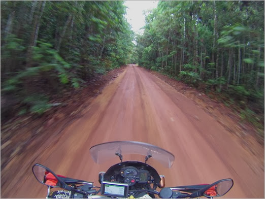
The article notes, "...the road at present is quite traversable." Interpret that to mean the road is passable. I rode the length, south to north, in early November 2012. From Lethem to Linden expect grave and dirt, for a short stretch a little sand and a few edge to edge puddles. The number of puddles will vary per rainfall, so search for annual precipitation by month, then plan accordingly. I put knobbie-ish tires on for Guyana. They drive on the left side in Guyana and in Suriname. I only passed a handful of cars until I got above Mabura.
The picture of the road in the article is pretty funny.

You will experience roads more like this...

North of Lethem you'll ride washboard on and off. Between the police check-in at Mabura and the ferry at the Esequobo river, the road is the lowest quality, biggest pot holes, edge to edge puddles (I encountered two) and the sandy stuff I mentioned. The sand isn't too bad. And that is coming from someone who believes sand is the product of the devil.
Between Linden and Georgetown its all tarmac. There is one monster pothole on the south side of Linden than nearly swallowed my bike. My attention lapsed for a moment and I felt sure I was going to wreak my front tire on the far edge of that crater, but only picked up a small dent in the front rim.
__________________
Peter B
2008/09 - NJ to Costa Rica and back to NJ
2012/13 - NJ to Northern Argentina, Jamaica, Cuba and back to NJ
2023 - Peru, Brazil, Paraguay, Argentina, Chile, Bolivia...back to Peru.
Blogs: Peter's Ride
|