Quote:
Originally Posted by TheWarden

That would be logical, except other GPS apps run on the same phone show the correct position.
Maps.me really doesn't cut it for a proper overlanding navigation tool, its just not advanced enough in its abilities. Fine for a free city turn by turn based navigation app but I still prefer Google or Apple Maps
|
Maybe i did not wrote it cleary, because of my english

- i`m sorry.
"
here" i did mention bevore - is an App, known formarly as Nokia Maps, based on Navteq who give the Mapsource to Toyota, Mercedes, BMW, VW - and offers in 95 Countrys turn by turn Navigation
as iOS / Android App - and Maps for 195 Countrys.

You can download the Maps by country too for offline use - which is handy abroad whithout coverage. While bying online, you too get traffic jam handling.
In my eyes the only good current solution for all doing an worldtrip, driving the panamericana or transafrica - or even need assistance while using an rental in foreign countries without builtin navigation. And it is
free.
From time to time we want to go to a specific destination (shop, Hotel, Mechanic, or to meet with someone) - also while overlanding.
Maps.me is fine for all of us, who are looking for offroad navigation, means orientation and not turn by turn. Maps.me could even do that - if you navigate in Peru from Arequipa to Puno - you will have a lot of fun (tested).
During Overlanding I usually dont need point to point navigation, while jumping from a wildcamp spot to the next - i just follow the tracks who looks nicer in a given direction.
Maps.me allows too to view the surrounding offline - to see where are villages, where forests, where a river/lake, POIs - also a point a offline Navigation Software didnt handle that good. Online is always better, but not always available.
So maps.me is for me and my undertanding for what we overlanders do - an important tool too - and on my
list of the most important apps for travel. Each listed app has his function, which the other tools could`nt do.
As i mentioned before, maps.me is also very nice for asking for something, and let people set an waypoint for you on your smartphone. That dont works on "here" that well (or even google maps if you are online).
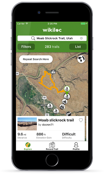
If it goes about offroading and to follow known 4x4 tracks worldwide, another tool is very handy:

wikiloc review:
https://www.4x4tripping.com/2020/07/...4-offroad.html
Guess such tools leads the Prius drivers to drive abroad :
https://www.youtube.com/watch?v=Rl2t1AkTC98
I guess the offline capability isnt that important anymore, most of us will buy a local simcard or a roaming package. But abroad the coverage isnt still that good, that you can use google maps during driving in Panamericana or anywhere else in remote areas.
Because each app has his own storage - you had to download each country you like to use during beeing offline - also in each app.
To the accuracy of Smartphone/Tablet with GPS: I did use just these iOS devices for navigation during the transafrica, europe, US and in south america - it works well. Some Glass/Frontscreens can block the signal a bit, there you should opperate with an external GPS receiver like mentioned there:
https://www.bluetoothtest.de/gps/ I did use apple smartphones and tablets (3G) as exklusive Navigation Unit in Toyota / BWM
without the need of an external receiver. It has been tested personally for over 100k kilometers (60`000 miles) travelling abroad.
//Edit: for the southern part of africa also this is handy - tracks4africa :
https://apps.apple.com/ch/app/tracks...de/id918481937
Surfy