 41Likes 41Likes
 |
|

18 Oct 2021
|
|
-
Veteran HUBBer
|
|
Join Date: Apr 2006
Posts: 2,368
|
|
|
I know zip about apples but I doubt it is a display anomaly. More probably in the type of map you have. In any case you can change the way a map looks by using a different .TYP file.
BC looks for a coding in the map header as I've said before- if it isn't there, the map usually fails to display.
|

18 Oct 2021
|
|
Registered Users
Veteran HUBBer
|
|
Join Date: Jul 2011
Location: Somewhere
Posts: 1,500
|
|
I get the peaks in Mapsource at 3km zoom, the same zoom as the pistes show up. The same with Basecamp at a 15km zoom level.
The better maps with more detail dont make route planning terribly easy, which is why I prefer the maps from Free worldwide Garmin maps from OpenStreetMap for planning. Hopefully the service may resume, its a shame to lose such a useful website.
On screen on the Montana when travelling I prefer the high detail of the topos
|

21 Oct 2021
|
|
-
Veteran HUBBer
|
|
Join Date: Apr 2006
Posts: 2,368
|
|
 It is not a Mac anomaly
Quote:
Originally Posted by Chris Scott

So you don't find the 'masses of peak icons' an issue? Maybe a Mac anomaly.
|
 (and I say this will all my [zero] knowledge of anything apples unless they come in a dish with sultanas, brandy, honey and lashings of custard 
It is to do with the data you do not want kept in the TYP file.
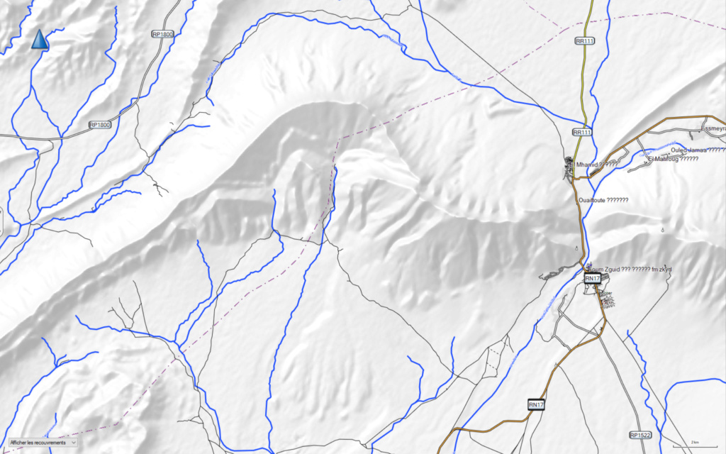
See below a copy of the image you posted showing those pesky peak icons
and
Using the same map as you but modded and in more or less the same area (Ouinouska) without any peaks at scale of 1km for clarity. No more peskies! The decision, of course, as to which you prefer is yours!
p.s thank you- my curiosity got me revisiting an old method which no longer worked so I spent a happy day yesterday being taught how the new kids on the block do it- this learning curve seems to get steeper these days 
Still, the good news is that the old grey matter can still absorb other stuff other than Chablis or Meursault!!! 
Anyone seen B-O-B today?
p.p.s I have left the elevations numericals in the map but these too can be removed as can any other offending icons!
Last edited by Toyark; 10 Nov 2021 at 10:31.
|

21 Oct 2021
|
|
Registered Users
Veteran HUBBer
|
|
Join Date: Jul 2011
Location: Somewhere
Posts: 1,500
|
|
|
I spent yesterday playing with the Opentopo maps.
For Europe you can download an installer for basecamp, but not for the Africa maps. (The basecamp installer version has a horrible look to it). Like Chris I couldn't get the Morocco maps to open in Basecamp.
So a bit of a play with OSM Combiner and using the GRnew typ file and I've got them installed and working in Basecamp.
Very impressed with these maps now, nice and clear with good detail. Haven't tried it in the Montana yet but I think they might become my new favourite mapset.
|

21 Oct 2021
|
|
-
Veteran HUBBer
|
|
Join Date: Apr 2006
Posts: 2,368
|
|
Quote:
Originally Posted by TheWarden

I spent yesterday plLike Chris I couldn't get the Morocco maps to open in Basecamp.
|
Ahem...
Answer is in post #27 above.
And again below:
The Ms version needs be written to the map header for any non-garmin maps then BC will read the map.
|

21 Oct 2021
|
|
Registered Users
Veteran HUBBer
|
|
Join Date: Jul 2011
Location: Somewhere
Posts: 1,500
|
|
|
made little sense TBH.
I just ran the file through OSM Combiner and let that install it. I also installed a number of other OTM maps in basecamp, these didn't load with the installer due to conflicts in the maptiles etc. Fixed using the error correction tool in Javawa GMTK and every things works fine
|

25 Oct 2021
|
|
-
Veteran HUBBer
|
|
Join Date: Apr 2006
Posts: 2,368
|
|
|
We may have been
talking across purposes.
Scottys' post was about an icon he did not like/want and I was referring to editing the .TYP file.
And making a map show up in BC.
Anyway, I'm glad you have what you need.
ATB
|

25 Oct 2021
|
|
Registered Users
Veteran HUBBer
|
|
Join Date: Jul 2011
Location: Somewhere
Posts: 1,500
|
|
|
Quite possibly
|

6 Jan 2022
|
 |
Super Moderator
Veteran HUBBer
|
|
Join Date: Jun 2000
Posts: 4,984
|
|
|
nakarte.me
Check out nakarte.me Russian mapping website where you can easily switch between four different aerial/satellite sources, as well as view loads of (mostly Russian) maps.
It does other things too, but i see now the zoom is not so good.
https://nakarte.me/#m=14/31.98041/-6.11878&l=S/D
Last edited by Chris Scott; 21 Feb 2022 at 15:16.
|

21 Feb 2022
|
|
Registered Users
HUBB regular
|
|
Join Date: Feb 2017
Location: Paris-France
Posts: 47
|
|
|
OTM files in Basecamp
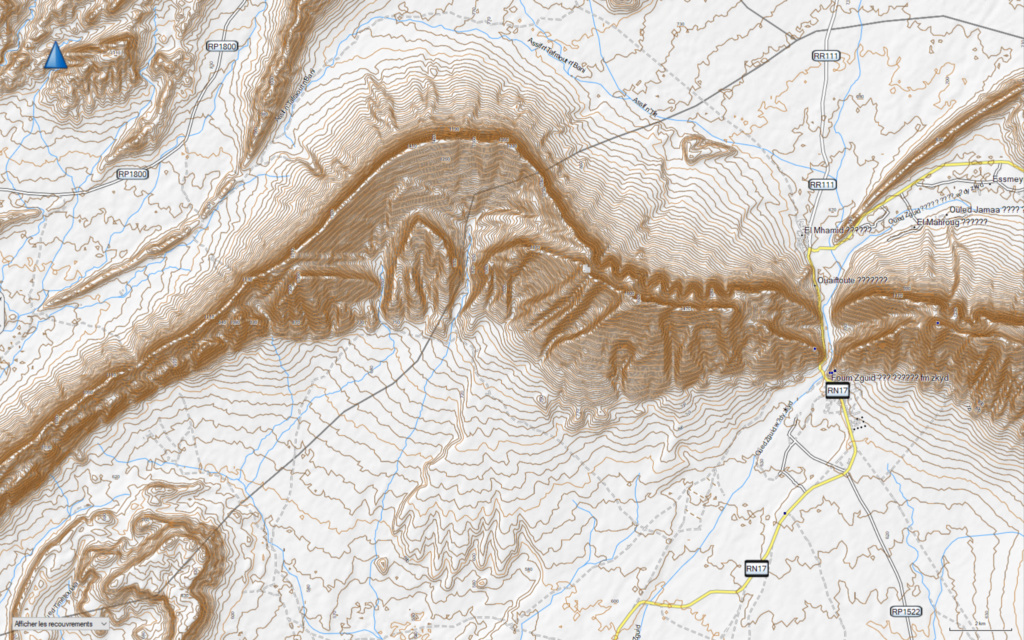
Following Chris's recommendation I've downloaded the OpenTopoMap Morocco and Contours , I managed to installed Morocco OTM in Basecamp with Gmaptool but then you don't get the same colors.
After few tries I managed to edit the files and get them in Basecamp by putting them on a USB card or SD card in a garmin folder.
So I have a simple map and a map with the contours.
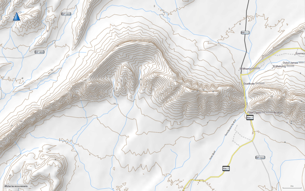
The render is not the same in basecamp as on the OTM website, the contour lines are less precise and you have top play with detail level when zooming.
Here are Basecamp screenshots:
Simple map

Map with contours high details

Map with contours medium details

Here are links to these edited maps if ever somebody need them.
Map without contours:
https://drive.google.com/file/d/1avi...ew?usp=sharing
Map with contours:
https://drive.google.com/file/d/1Tc-...ew?usp=sharing
Last edited by FDC75; 21 Feb 2022 at 16:13.
|

21 Feb 2022
|
|
Registered Users
Veteran HUBBer
|
|
Join Date: Jul 2011
Location: Somewhere
Posts: 1,500
|
|
|
If you combine the OTM map and contours using OSM Combiner and the GRNew typ file it produces a very nice map set for use in Basecamp.
I’ve also loaded it on my Garmin 700i but I think it might be too detailed on the smaller screen.
I’ll post some screen shots later
|

22 Feb 2022
|
|
Registered Users
Veteran HUBBer
|
|
Join Date: Jul 2011
Location: Somewhere
Posts: 1,500
|
|
|
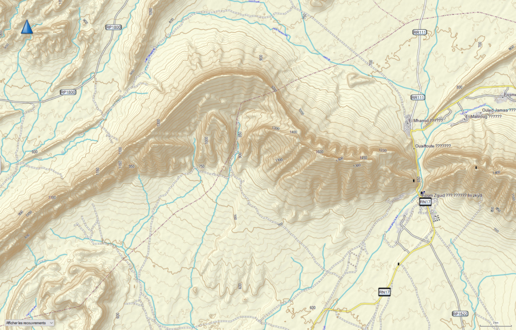
tried to copy your screen shot.
3km zoom and highest detail
|

22 Feb 2022
|
|
Registered Users
HUBB regular
|
|
Join Date: Feb 2017
Location: Paris-France
Posts: 47
|
|
I tried with OSM Combi and the result in Basecamp is better for the render of contour lines than what I got with Gmaptool.
Here's what I get in Bacecamp with higher details.

It changes the background colour but it's not a big problem.
Thanks.
|

28 Dec 2022
|
|
Registered Users
Veteran HUBBer
|
|
Join Date: Jul 2011
Location: Somewhere
Posts: 1,500
|
|
Quote:
Originally Posted by Chris Scott

Check out nakarte.me Russian mapping website where you can easily switch between four different aerial/satellite sources, as well as view loads of (mostly Russian) maps.
It does other things too, but i see now the zoom is not so good.
https://nakarte.me/#m=14/31.98041/-6.11878&l=S/D |
Been using nakarte quite a bit for route research and found some great new pistes as a result.
Elsewhere today someone posted this link to it with the old Morocco 1:250k maps available as a custom layer (dont ask me how!)
https://nakarte.me/#m=12/31.45839/-6...NUb3AiOnRydWV9
|
|
Currently Active Users Viewing This Thread: 1 (0 Registered Users and/or Members and 1 guests)
|
|
|
 Posting Rules
|
You may not post new threads
You may not post replies
You may not post attachments
You may not edit your posts
HTML code is Off
|
|
|
|

Check the RAW segments; Grant, your HU host is on every month!
Episodes below to listen to while you, err, pretend to do something or other...

2020 Edition of Chris Scott's Adventure Motorcycling Handbook.
"Ultimate global guide for red-blooded bikers planning overseas exploration. Covers choice & preparation of best bike, shipping overseas, baggage design, riding techniques, travel health, visas, documentation, safety and useful addresses." Recommended. (Grant)

Led by special operations veterans, Stanford Medicine affiliated physicians, paramedics and other travel experts, Ripcord is perfect for adventure seekers, climbers, skiers, sports enthusiasts, hunters, international travelers, humanitarian efforts, expeditions and more.
Ripcord Rescue Travel Insurance™ combines into a single integrated program the best evacuation and rescue with the premier travel insurance coverages designed for adventurers and travel is covered on motorcycles of all sizes.
(ONLY US RESIDENTS and currently has a limit of 60 days.)
Ripcord Evacuation Insurance is available for ALL nationalities.
What others say about HU...
"This site is the BIBLE for international bike travelers." Greg, Australia
"Thank you! The web site, The travels, The insight, The inspiration, Everything, just thanks." Colin, UK
"My friend and I are planning a trip from Singapore to England... We found (the HU) site invaluable as an aid to planning and have based a lot of our purchases (bikes, riding gear, etc.) on what we have learned from this site." Phil, Australia
"I for one always had an adventurous spirit, but you and Susan lit the fire for my trip and I'll be forever grateful for what you two do to inspire others to just do it." Brent, USA
"Your website is a mecca of valuable information and the (video) series is informative, entertaining, and inspiring!" Jennifer, Canada
"Your worldwide organisation and events are the Go To places to for all serious touring and aspiring touring bikers." Trevor, South Africa
"This is the answer to all my questions." Haydn, Australia
"Keep going the excellent work you are doing for Horizons Unlimited - I love it!" Thomas, Germany
Lots more comments here!

Every book a diary
Every chapter a day
Every day a journey
Refreshingly honest and compelling tales: the hights and lows of a life on the road. Solo, unsupported, budget journeys of discovery.
Authentic, engaging and evocative travel memoirs, overland, around the world and through life.
All 8 books available from the author or as eBooks and audio books
Back Road Map Books and Backroad GPS Maps for all of Canada - a must have!
New to Horizons Unlimited?
New to motorcycle travelling? New to the HU site? Confused? Too many options? It's really very simple - just 4 easy steps!
Horizons Unlimited was founded in 1997 by Grant and Susan Johnson following their journey around the world on a BMW R80G/S.
 Read more about Grant & Susan's story
Membership - help keep us going!
Horizons Unlimited is not a big multi-national company, just two people who love motorcycle travel and have grown what started as a hobby in 1997 into a full time job (usually 8-10 hours per day and 7 days a week) and a labour of love. To keep it going and a roof over our heads, we run events all over the world with the help of volunteers; we sell inspirational and informative DVDs; we have a few selected advertisers; and we make a small amount from memberships.
You don't have to be a Member to come to an HU meeting, access the website, or ask questions on the HUBB. What you get for your membership contribution is our sincere gratitude, good karma and knowing that you're helping to keep the motorcycle travel dream alive. Contributing Members and Gold Members do get additional features on the HUBB. Here's a list of all the Member benefits on the HUBB.
|
|
|