For navigate abroad, follow some small tracks normal Road Navigation Apps or units like Garmin Nüvi don't really works well.
Maybe some people here now the history of the App MotionX who allows us to download really huge areas of Google/Bing-Maps for offline use. At the end of 2011 google insists that the Appmakers has to disable this Option. At the end of 2012 also Bing dont allow to download huge areas - and MotionX had to disable this with a new Version.
But let us talk about today and not about the history


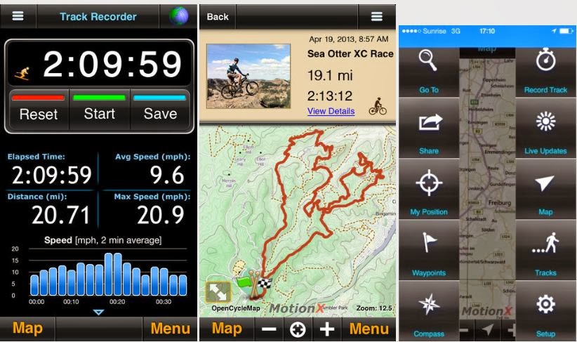
MotionX is not just an App for showing different Maps and views, it is too an Trackrecorder, let you import / export Tracks and Waypoints, let you share your tracks.
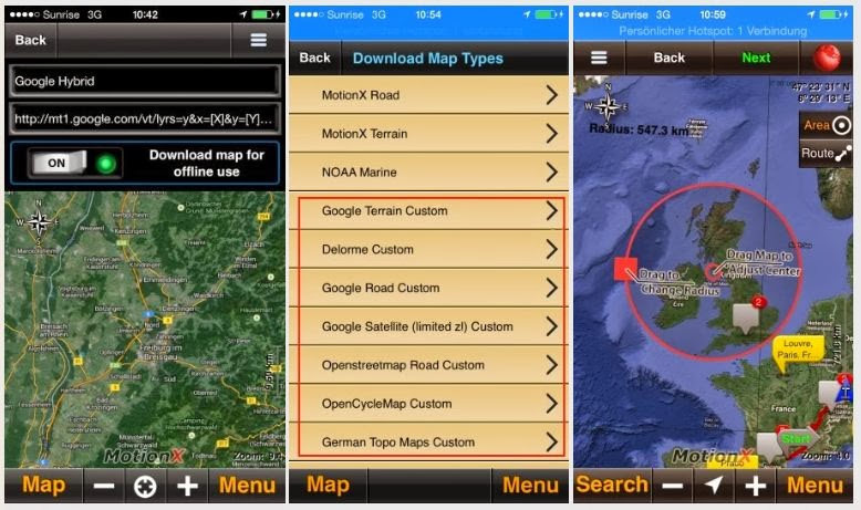
The app maker now found a lucrative way out of the download restrictions. Through an in-App purchase about 5 USD you can unlock the function "Custom Maps "
That allows you to enter the Tiles / Map server you need. When you enable the switch to be able to download the source from that server - you had to accept that you will respect the legal rights of the provider.
A smart move - to now the user can enter the tiles / map server he wants and the Map Provider would have to complain at the enduser when he don't respect the legal issues. MotionX is not responsible for what the user may enter there, they just offer a option.
What does that mean for us? We can download Google / Bing / NavTec Maps and Satellite view for orientation abroad far from internet coverage.
It is just something for orientation - it has no turn to turn navigation like the Navigon, TomTom or Garmin App (or Navigation-Units).

It can help you there where the normal road navigation usually end, can help you to find a spot for a wild camp at sample, where there is no house/hats on the satellite view.
If you like more informations:
4x4tripping: Offroad Navigation with MotionX
There you find too some useful Tile / Map Server.
We did navigate with that solution during our
Transafrica, specially at central africa in Cameron, Congo and DrCongo you cannot buy better GPS Maps.
If you travel by bike you will have to protect your expensive iOS Unit i guess, there are special cases around.
To repeat - this is not for normal road navigation. This solution help you there where you don't have other sources and where you don't have a 3G /4G / LTE mobile network.
For africa at sample i strongly suggests to buy too
Tracks4Africa for iPhone/iPad and to use at sample apps like TomTom Marocco and Navigon South africa at sample to have a good POI Database for Police, Hospitals and to can use point to point navigation on the roads.
There are also solution for Android Phones around, but unfortunately not that easy like showed above, specially if you like to download really huge areas. MotionX also don't restrict the download speed, it deliver what the provider has to give. Anyway I suggests to download just that areas you really need, because it need some time anyway...
Please discuss here just iOS related stuff, i will start an additional thread about android.
Surfy