Quote:
Originally Posted by furious

OSM maps are the most detailed digital maps I found. Still, it's clear that they don't have enough details on Africa. I mean, even Lonely Planet guides, which are not proper maps, are more detailed!
|
Sorry but I have to say, this kinda seems a very irrational comparison. Its like you have hand picked the examples to tell the story you wanted to tell rather than offering meaningful comparisons. You have simply focused on the areas where lonely planet has detailed printed maps ... which are for a tiny selection of a continent.
You seem to have deliberately used the wrong level of zoom / detail. You see one important detail you didnt mention about paper maps, is that you cant zoom in on them. Thats why electronic maps offer lower detail at greater zoom out. ... so as not to clutter the screen. If you want more detail you just zoom in.
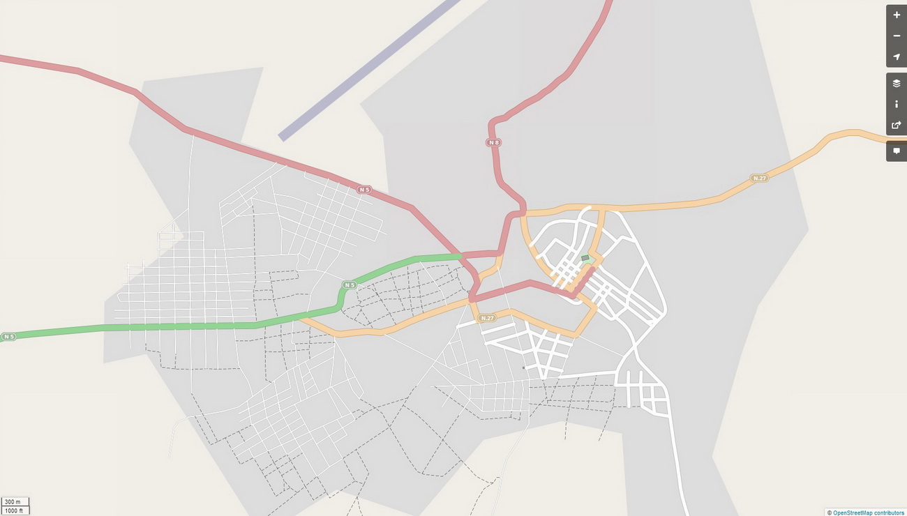
For example, your OSM picture of the Banjul area ... if you zoomed in one more click, you get a similar amount of detail:
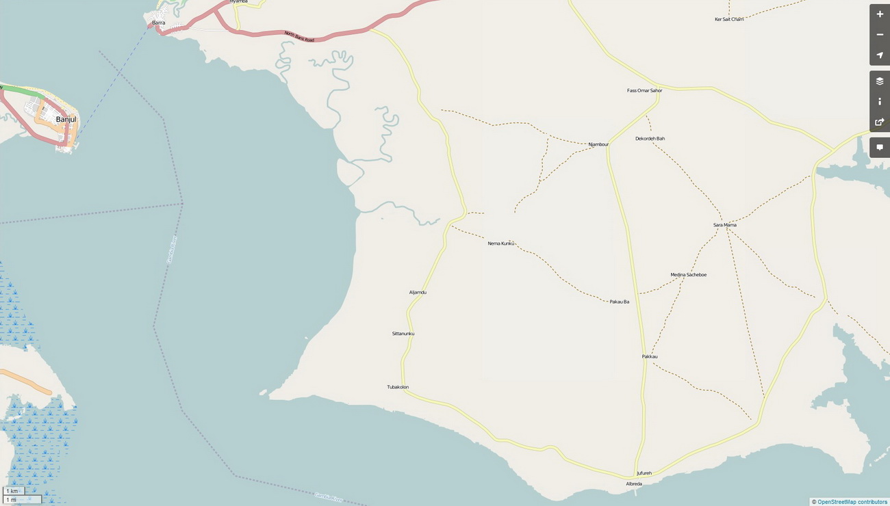
You simply cant compare detail from paper maps with electronic maps at a similar level of zoom. Paper maps cant be zoomed, so they put as much detail as possible on the one layer. Electronic maps can be zoomed, therefore more detail is available as you zoom in. They are deliberately designed to be uncluttered! You cant compare the two at a simple single level of zoom. Electronic maps and paper maps present information very differently. They are not the same animal.
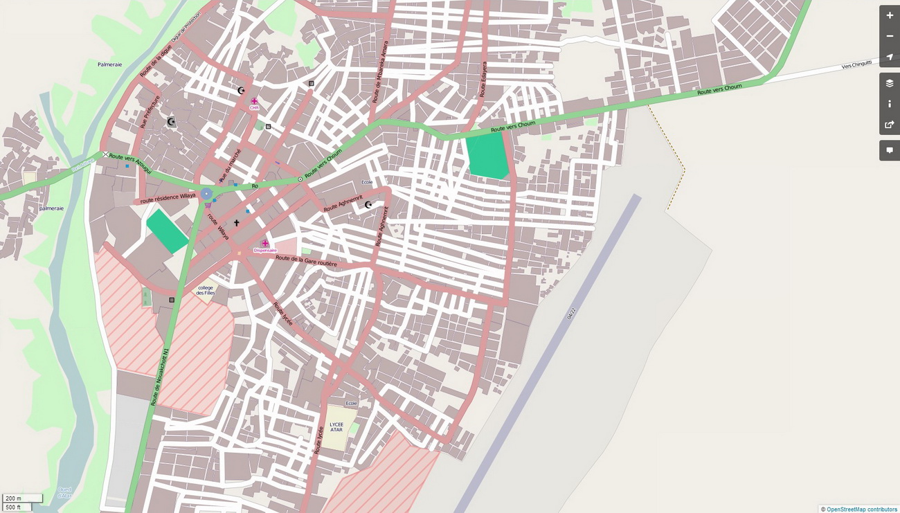
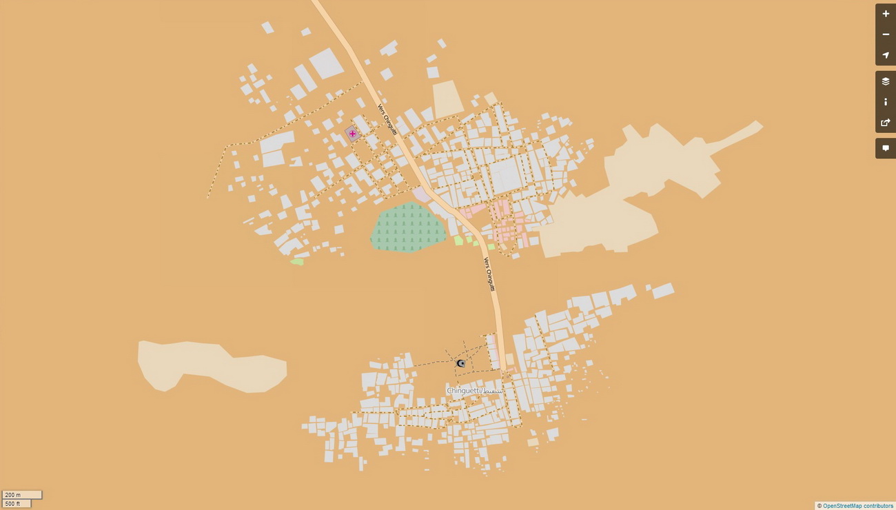
And only comparing the areas where lonely planet actually has maps isnt a rational comparison either ... I mean does lonely planet offer you this detail ... (the next two maps are kinda important in the comparison of paper vs electronic maps of the Adrar region)
Of Atar?
Of Chinguetti?
You only offered the zoomed out OSM map below in your Mauritania comparison, and didnt offer the additional info in the forms of the maps above ... which is kinda important in judging the level of detail offered by OSM in comparison with the other two sources, isnt it?:
Quote:
Originally Posted by furious
Here is a comparison about Mauritania:
Open Street Maps
 |
- - -
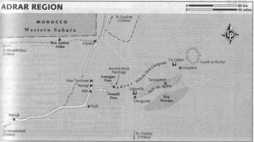
I can turn your argument on its head by saying: look at the these two comparisons of the Atar region ... which is more detailed ??
Lonely Planet guide
or OSM
- - -
Lets pick a random spot in Africa ... what does Lonely Planet offer in terms of maps of Labe in Guinea?
I bet there are tens of thousands of areas in Africa where OSM is more detailed than Lonely Planet, or where Lonely Planet have no maps at all. Just about every village in fact. Your method of comparison is just not logical. The conclusion that Lonely Planet maps are more detailed, for Africa as a whole (as opposed to a hand selected handful of locations), is absolutely unsustainable.


 1Likes


 Threaded Mode


