Hi all,
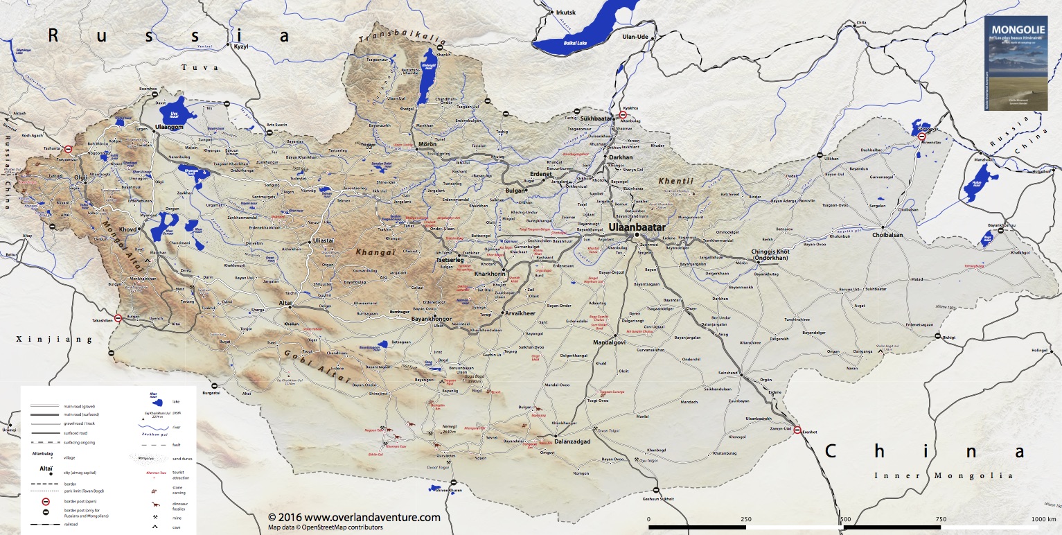
we've just releasing a new guidebook about Mongolia, and although it is in French only, we're giving away a full-scale map of the country with the majors roads and landmarks.
In our experience there isn't a good map about Mongolia, all are pretty much wrong half of the place. This one may not be much better but it's free (as in free

). So you can download it, print it, etc.. but do not modify it and please do not upload it to other websites. It's based mostly on our own experience, but also other's and OpenStreetMap as well.
Yes, you can find the same data in OpenStreetMap, but it's not easy to print and doesn't give a good sense of hierarchy. Indeed, the digital maps made out of it (think maps.me, OruxMaps, etc.. ) are difficult to use because you have to zoom in a lot to see some otherwise important tracks. Why ? because any unsurfaced road could be tagged as a "primary road", a "secondary road", a "track" or a random "road", depending on the contributor's mood, but the result is that they show at very different zoom levels. The scheme is well tuned for western countries, but doesn't quite work in Mongolia.
Note: there are thousands of tracks in Mongolia that could qualify as roads, or not, depending on how you look at it. So all maps are very subjective, including this one. But I believe it can be very useful, particularly in the early stages of planning, to get the full picture. The landmarks correspond to the selection of itineraries described in our book, so they're far from exhaustive.
Of course, all feedback and corrections are welcome, I'd like to keep it current and improve on it, as a lot of road building is happening right now in Mongolia.
Enjoy !
Laurent + Cécile
Sorry I can't upload it here as an attachment as it's too big - even with low-res terrain.
The PDF map can be downloaded here:
https://www.overlandaventure.com/categorie-produit/maps/
And for those who get along with French, our guidebook can be ordered here:
Overland Aventure


 14Likes


 Threaded Mode