(New username for an old member of the forum)
I got a NK visa in Yerevan for AMD 3000. Painless, but I was told there that areas such as Füzuli and Qubadlı were off-limits 'due to our [Nagorno Karabakh] army being there'....
I was also told I could only enter at the Aghuli Border post on the main Goris - Stepanakert Highway.
I am driving a Toyota 4x4. No special permission is required to take a car into NK (although it is expensive to bring a car into Armenia).
Despite this advice, I decided to enter NK over the Zod Pass. There was a police checkpoint but I was told to keep going, no registration. I then turned south to Karavachar, which is a ruin of a town with a skeleton population of Armenians. Then further south to Tsar, passing two hot springs, not the type that one can bathe in unfortunately.
Tsar was rather a surprise, once a very big village, it is 95% destroyed, of dozens of houses there might be 5 or 10 now occupied. There is a poignant Azerbaijani cemetery above the village. Friendly locals told me that there is a track up onto the grasslands above the village, reaching the two Ala Qol Lakes (they still used the Azeri names) and on down to Jermuk in Armenia.

The track was initially pretty good, but requires a high clearance vehicle, especially when going down to Jermuk, which is an awful track. The two lakes are stunning, and the landscape very similar to Song Kol in Kyrgyzstan (and pretty much at the same altitude).

My passport and visa details were noted in Tsar by some guard post, but otherwise there was no demarcation and no control at the 'border'.
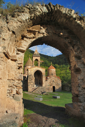
Back in Armenia, after visiting Ughtasar, Zorats Karer and Tatev, I drove to Stepanakert on the beautiful highway (which is better than any road I drove on in Armenia!). I spent a few days in Stepanakert and Shushi, then left up past Gandzasar to Dadivank.

Passing Sarsang Reservoir.

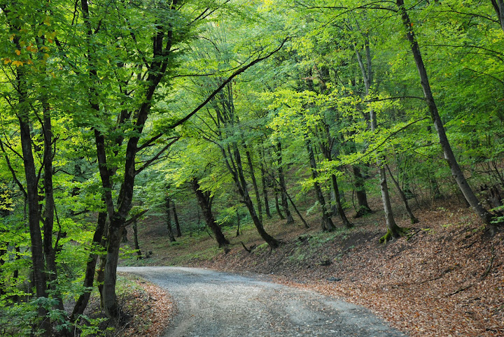
Taking a different road through beautiful forest towards Martakert, which is not an interesting place.

Then south past Tigranakert and Vankasar Monastery, quite picturesque but I was in a hurry to go south, so I did not go in.

The road then swings back towards Askeran and Stepanakert, but heading straight on takes you to the movingly ruined town of Ağdam. I drove straight past a big army base and the soldiers just waved. No one stopped the car. I drove straight to the mosque where one can climb the minarets and see the swathes of destruction. A couple of local guys came up and we had a brief chat. They seemed a touch suspicious of my motives for going, and my questions, but were pleasant, and the conversation soon turned to the ususal 'can I buy your car?'

From Ağdam I continued south, under the old railway bridge where the tracks have disappeared, though the fields are being partly farmed (and grazed). Getting towards Martuni, life starts to return, just. Martuni is a one-horse town with a bland modern church and similar muddy streets and partly ruined buildings to, similar to Martakert.
I took the Füzuli road south from Martuni, then turned west after a few kilometres (signed) to Amaras Monastery, passing the large and lively village of Chartar, from where there is a perfect asphalt road. Amaras is 7km down a turn from this road. It is not spectacular like Gandzasar or Dadivank, but interesting for its fortifications and pleasant setting, plus there are still bullet scars on the south façade where there is a large relief of a cross. From Amaras I drove on muddy tracks through the fields to Füzuli, passing several destroyed villages.

Füzuli is a ruin, like Ağdam but without the mosque. Like Ağdam, there were a few squatter and shepherds living amongst the ruins, but the place is trashed. There are some remains of bus shelters and an interesting old Soviet road sign gantry pointing the way to Baku... you would not want to try that road! I didn't hang around too much as I was always worried of being apprehended and sent back towards Stepanakert.

South from Füzuli the road deteriorates to a crappy dirt track, but is still passable in a 2WD. I starts to undulate over low, barren hills. At the junction to Hadrut, there was a police jeep waiting, but I think the guy was so shocked to see a foreign car that he just watched me go by.
Next was Cǝbrayıl, also trashed, and then more trashed villages. There is then a stretch of overgrown dual carriageway dropping to the Aras Valley and another unnamed, trashed junction town. I drove a little bit east but didn't want to run into the army, so turned around and headed west. The road passes yet more trashed villages and towns, such as Soltanlı, where there is the odd monument. Side tracks head down to the Khodaafrin bridges and the new reservoir on the Aras. The road along the valley is totally empty, and not in such bad condition.

An Azerbaijani mausoleum in Məmmədbəyli with nice brickwork around the portal.

Finally, around Yervanavank, life returns... just. A few Armenians living in the ruins, or in newly constructed houses. The main road dog-legs around a washed out section of the old road, close to the turning for Berdzor. I continued west to Mijnivan, which must once have been very beautiful, but is now pretty trashed.
There is a road on to Meghri, but I was advised that it is very bad. I took the road north-west through Zangilan to Kapan in Armenia. Again, no 'border' control whatsoever.
All in all a very sobering trip, and although it might not be everyone's idea of fun to drive through endless destruction and dereliction, it really does help to get a different perspective on the conflict that the glossiness of Stepanakert.
For pictures, see
https://picasaweb.google.com/1136194...esserCaucasus#
EO