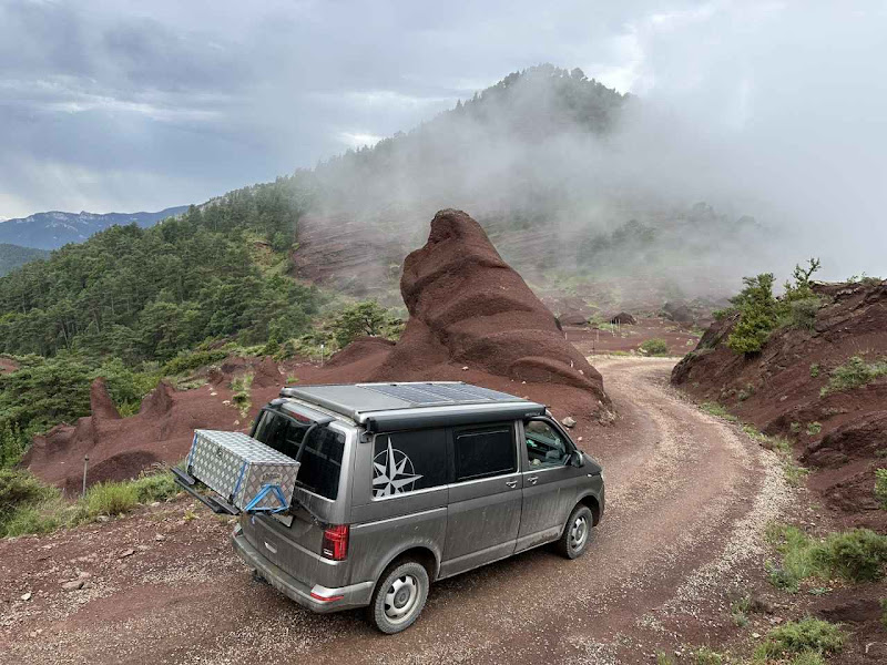
Anyone planning an off-road trip in the Pyrenees, the Western Alps, or Iceland will eventually face the exciting challenge of route planning. Off the paved roads, it’s essential to find accessible field, forest, and country paths that can be navigated by off-road vehicles – all while avoiding routes blocked by gates or restricted access.
The art of a successful off-road tour lies in connecting a starting point with the final destination while including as many scenic routes, landscapes, and landmarks as possible.
In my article, I provide a comprehensive look at how I planned our 16-day Trans-Pyrenees tour from the Mediterranean to the Atlantic. It explains each step of the process in detail: from gathering GPX tracks from the internet and friends, evaluating and organizing the routes, to importing them into popular navigation apps. Ideal for anyone looking to prepare their own off-road journey with care and a sense of adventure!
Article: Off-Road Route Planning: Roadbook vs. DIY Navigation
Planning and getting into track navigation can be time-intensive. In my post, I share a method that leverages other travelers’ groundwork, making it possible to create a reliable route with a manageable amount of effort. I’d be very grateful for any tips, suggestions, and ideas from fellow readers – as there’s always another journey on the horizon!
I did wrote the article because a
Userquery at HUBB
Surfy


 2Likes


 Linear Mode


